
The Role of Remote Sensing in Early-Stage Mineral Development: A Case Study


Introduction to Remote Sensing in Mineral Exploration
Remote sensing technology has emerged as a revolutionary tool in mineral exploration, offering a wealth of benefits for early-stage development. By utilizing satellite imagery and aerial surveys, geologists can identify potential mineral deposits without the need for immediate ground presence. This not only reduces exploration time but also minimizes environmental impact.
Understanding the Basics of Remote Sensing
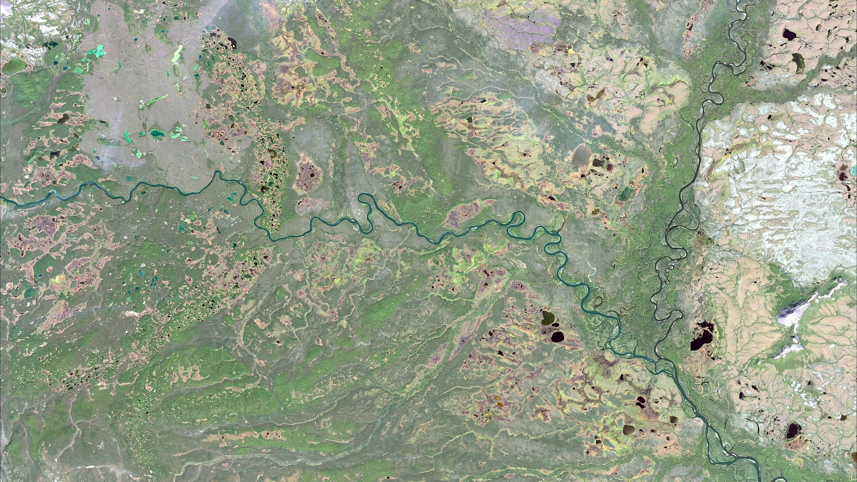
Remote sensing involves the detection and monitoring of physical characteristics of an area by measuring its reflected and emitted radiation. This is typically done from a distance, using satellites or aircraft. The data collected provides valuable insights into the geological features of a region, helping geologists pinpoint areas with high mineral potential.
Advantages of Remote Sensing
One of the main advantages of remote sensing is its ability to cover large and inaccessible areas quickly. This is particularly beneficial in regions with challenging terrains or where on-ground exploration is difficult. The technology also offers high-resolution imagery, allowing for detailed analysis of geological formations.
Furthermore, remote sensing can be cost-effective. Traditional exploration methods often require significant financial investment, whereas remote sensing offers a more budget-friendly alternative, especially during the initial stages of mineral development.
Case Study: Successful Application in Mineral Development
To illustrate the effectiveness of remote sensing, consider a case study where a mining company employed this technology in its early-stage mineral exploration. The company targeted a remote region known for its rich mineral deposits. By analyzing satellite imagery, they identified promising areas that warranted further investigation.
Analysis and Interpretation of Data
The data collected through remote sensing was meticulously analyzed, revealing anomalies in the terrain that suggested the presence of valuable minerals. These findings guided the company's decision to conduct more targeted ground surveys, ultimately leading to a successful discovery of a new mineral deposit.
This case study demonstrates how remote sensing can streamline the exploration process, reducing both time and costs associated with traditional methods.
The Future of Remote Sensing in Mineral Exploration
As technology continues to advance, the role of remote sensing in mineral exploration is expected to grow. With the integration of artificial intelligence and machine learning, the accuracy and efficiency of remote sensing analyses will improve, offering even greater insights into potential mineral sites.
Moreover, the adoption of multispectral and hyperspectral sensors will enable the detection of specific mineral types, further enhancing the exploration process. This technological evolution holds the promise of more sustainable and efficient mineral development practices in the future.

Conclusion
Remote sensing has proven to be an invaluable tool in early-stage mineral development, offering a strategic advantage in identifying promising sites quickly and cost-effectively. By leveraging this technology, mining companies can enhance their exploration strategies and reduce their environmental footprint.
As the industry continues to embrace technological advancements, remote sensing will undoubtedly play a pivotal role in shaping the future of mineral exploration, driving innovation and sustainability in the sector.