
Remote Sensing in Mineral Exploration: Innovative Techniques and Technologies


Introduction to Remote Sensing in Mineral Exploration
In recent years, the field of mineral exploration has been revolutionized by advancements in remote sensing technologies. These innovative techniques allow geologists and exploration companies to identify potential mineral deposits from afar, significantly reducing the time and cost associated with traditional methods. Remote sensing provides a comprehensive overview of large areas, making it an invaluable tool in the early stages of mineral exploration.
The Role of Satellite Imagery
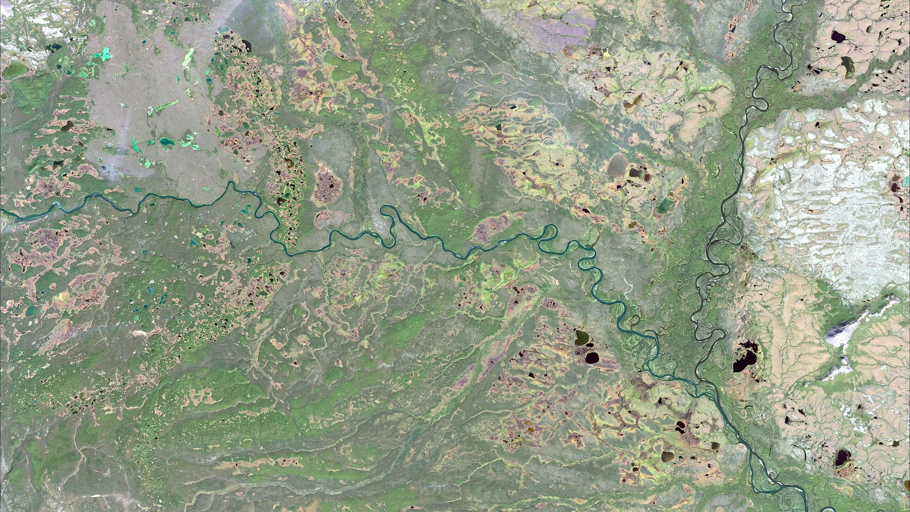
One of the most significant advancements in remote sensing for mineral exploration is the use of satellite imagery. Satellites equipped with sophisticated sensors capture data across various spectral bands, allowing for the identification of mineral-rich areas. The data collected can highlight subtle differences in surface materials, which are indicative of underlying mineral deposits. This capability enables exploration teams to focus their efforts on the most promising locations.
Satellite imagery is particularly effective in remote or inaccessible regions where traditional ground-based exploration is challenging. By analyzing the spectral signatures of different minerals, scientists can create detailed maps that guide further exploration efforts. This approach not only improves efficiency but also minimizes environmental impact.
Airborne Remote Sensing Techniques
In addition to satellite imagery, airborne remote sensing techniques have become crucial in mineral exploration. Aircraft equipped with advanced sensors, such as LiDAR and hyperspectral cameras, provide high-resolution data that complements satellite observations. These airborne systems can cover vast areas quickly, offering detailed information about the earth's surface composition.

LiDAR technology, for example, uses laser pulses to create accurate topographic maps. This information is essential for understanding the geological structures that may host mineral deposits. Similarly, hyperspectral imaging captures data across hundreds of spectral bands, allowing for precise identification of minerals based on their unique spectral signatures.
Ground-Based Remote Sensing Methods
While satellite and airborne techniques offer broad coverage, ground-based remote sensing methods provide localized and detailed data. Technologies such as ground-penetrating radar (GPR) and magnetometers are commonly used to detect subsurface anomalies indicative of mineral presence. These methods are often employed in conjunction with remote sensing data to verify findings and refine exploration strategies.
Ground-based remote sensing is particularly useful in areas with complex geology where surface indicators might be obscured. By integrating data from multiple sources, exploration teams can develop a more comprehensive understanding of potential mineral deposits.
Integration of Remote Sensing Data
The true power of remote sensing in mineral exploration lies in the integration of data from various sources. By combining satellite, airborne, and ground-based data, geologists can create detailed models that highlight prospective mineral-rich areas. This integrated approach enhances decision-making and reduces the risk associated with mineral exploration projects.
Advanced software tools are used to process and analyze large datasets, transforming raw data into actionable insights. These tools enable exploration teams to visualize complex geological structures and identify patterns that may indicate mineralization.
Benefits and Challenges
Remote sensing offers numerous benefits in mineral exploration, including cost savings, improved efficiency, and reduced environmental impact. By identifying promising sites early in the exploration process, companies can allocate resources more effectively and minimize unnecessary drilling activities.
However, remote sensing also presents challenges. The interpretation of remote sensing data requires specialized expertise, and there can be limitations in detecting certain types of minerals or in areas with dense vegetation cover. Despite these challenges, ongoing advancements in technology continue to enhance the capabilities of remote sensing techniques.
The Future of Remote Sensing in Mineral Exploration
The future of remote sensing in mineral exploration looks promising as technology continues to evolve. New developments in sensor technology and data processing are expected to further improve the accuracy and efficiency of mineral detection. Additionally, collaborations between technology providers and exploration companies will drive innovation and adoption of these advanced techniques.

As the demand for minerals increases globally, remote sensing will play an increasingly vital role in meeting this demand sustainably. By leveraging cutting-edge technologies and techniques, the industry can continue to explore new frontiers while minimizing its environmental footprint.