
How Remote Sensing is Revolutionizing Mineral Discovery in Zambia


Introduction to Remote Sensing in Mineral Discovery
In recent years, remote sensing technology has emerged as a game-changer for mineral exploration, offering new ways to identify and analyze mineral deposits effectively. This innovative approach is particularly influential in regions like Zambia, known for its rich mineral resources. Remote sensing provides a non-invasive method to gather critical data, helping geologists and mining companies make informed decisions.
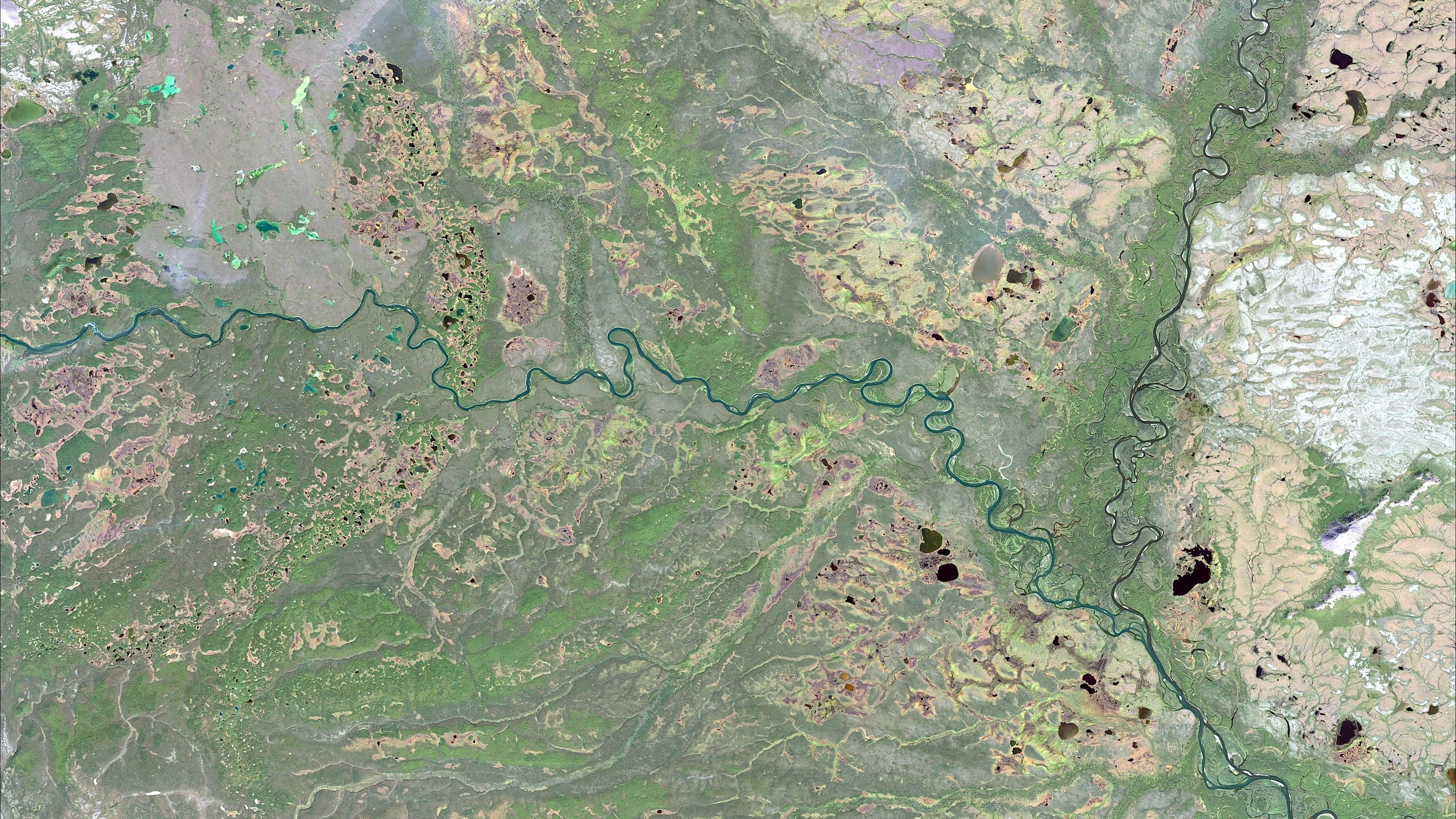
Remote sensing involves the use of satellite or aerial imagery to detect and monitor physical characteristics of an area from a distance. This technology can cover vast and often inaccessible terrains, making it highly valuable in mineral exploration. It allows for the collection of data on large scales without the need for extensive ground surveys.

The Role of Remote Sensing in Zambia
Zambia is one of the largest producers of copper and other minerals in Africa. The traditional methods of mineral exploration in Zambia often involved extensive fieldwork and labor-intensive processes. However, with the advent of remote sensing technology, these methods are being complemented with more efficient and effective techniques.
Remote sensing is particularly useful in Zambia because it can quickly identify areas with high mineral potential. By analyzing satellite images, geologists can detect geological features that are indicative of mineral deposits. This capability significantly reduces the time and cost associated with traditional exploration methods.
Advantages of Using Remote Sensing
There are several advantages to using remote sensing for mineral discovery in Zambia:
- Cost-effectiveness: Reduces the need for expensive and labor-intensive field surveys.
- Accessibility: Allows exploration in remote and hard-to-reach areas.
- Speed: Provides quick access to data over large areas.
Technological Innovations in Remote Sensing
The advancements in remote sensing technology include the use of hyperspectral imaging, which can capture a wide spectrum of light beyond the visible range. This capability allows for the detection of specific minerals based on their unique spectral signatures. In Zambia, hyperspectral imaging is proving to be an invaluable tool for identifying mineral-rich zones.
Moreover, the integration of remote sensing data with Geographic Information Systems (GIS) enhances the precision and effectiveness of mineral exploration. GIS enables the layering of different data types, such as topographical and geological maps, resulting in more comprehensive analyses.
Challenges and Considerations
While remote sensing offers numerous benefits, there are challenges to consider. The accuracy of remote sensing data can be affected by factors such as atmospheric conditions and the resolution of the imagery. Additionally, interpreting the data requires skilled professionals who can analyze complex datasets.
The Future of Mineral Discovery in Zambia
The integration of remote sensing technology in mineral discovery is paving the way for more sustainable and efficient mining practices in Zambia. As technology continues to evolve, it is expected that remote sensing will become even more integral to the mining industry, driving economic growth and ensuring the responsible extraction of resources.
Ultimately, remote sensing not only revolutionizes how minerals are discovered but also contributes to the broader goals of environmental conservation and sustainable development. By minimizing the environmental impact associated with traditional exploration methods, remote sensing supports a more balanced approach to resource management.